Danger level
 |
|  |  |

![]()
Stable situation, watch out for areas with new snow.
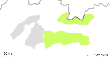
In the Tatras and Low Tatras there is only a SMALL avalanche danger, 1st degree. The cooling of the last few days has caused stabilization and freezing of the snow cover. Up to 5 cm of new snow has fallen. Avalanche release is possible only sporadically on exposed slopes with new snow. Spontaneous avalanches are not expected.
Snowpack
The snow cover froze and stabilised due to Monday's cold snap. Up to 5 cm of new snow has been added locally on its surface during Monday, and light snowfalls will continue. Fresh to strong mainly north-westerly winds up to 15 m/s will blow. This will transport snow mainly to leeward SE exposures. Continuous snow cover will be located between 1300 and 1700 m above sea level, depending on orientation. Its height reaches 30 to 150 cm, with the most snow in the Low Tatras.
Tendency
no significant change