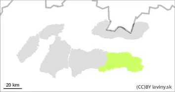
In the eastern part of the Low Tatras there is only a SMALL avalanche danger, level 1. Avalanches are not expected
Snowpack
Tuesday's weather will be influenced by a passing cold front. The snow cover has frozen and stabilised due to Monday's cold snap. Only a dusting of new snow was added to the surface during Monday, and light snowfall will continue through Tuesday. Fresh to strong mostly northwest winds up to 15 m/s will blow. Continuous snow cover will be found from 1300 to 1700 m above sea level, depending on orientation. Its height reaches 20 to 100 cm.
Tendency
with the expected development of the weather persisting.
bl
Danger level
Avalanche Problem
Wind slab
Overall (cooling) stabilized situation, watch out only for locally blown new snow.
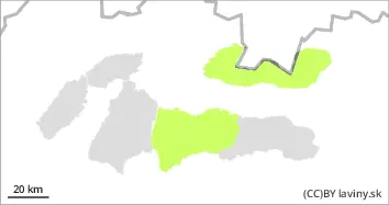
In the Tatras and Low Tatras there is only a SMALL avalanche danger, 1st degree. The cooling of the last few days has caused hardening of the snow cover. Avalanche release is possible only with higher additional loads on exposed slopes with new snow, which should fall during Monday and Tuesday. Spontaneous avalanches are not expected.
Snowpack
Tuesday's weather will be influenced by a passing cold front. The snow cover has frozen and stabilised due to Monday's cold snap. Locally up to 5 cm of new snow has been added to the surface during Monday and light snowfall will continue during Tuesday. Fresh to strong mainly north-westerly winds up to 15 m/s will blow. This will transport snow mainly to leeward SE exposures. Continuous snow cover will be located between 1300 and 1700 m above sea level, depending on the orientation. Its height reaches 30 to 150 cm, with the most snow in the Low Tatras.