Danger level
 |
![]()
The cooling will cause the snow cover to harden.
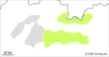
In the Tatras and Low Tatras there is only a SMALL avalanche danger = 1st degree. Snow cover is generally stable. The snow from the last snowfall perode has melted and stabilized. During Sunday morning only light snowfalls are expected from 1300 m above sea level. However, cooling and strong winds will result in only light accumulation. Avalanche release is possible only sporadically on exposed slopes. Spontaneous avalanches are not expected.
Snowpack
During Sunday, the weather will be influenced by the interface between a pressure high and a cold front, with a noticeable cooling . Expect initially partly cloudy to cloudy weather with light snow showers. Snow cover is generally stable. The snow from the last snowfall has already remade and settled. Depending on the orientation, continuous snow cover is between 1300 and 1700 m above sea level. Its height reaches 30 to 150 cm, with the most snow in the Low Tatras.