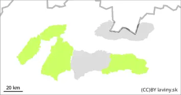
Danger level
 | 1700m |
|  |
|  | ||||
| |
|  |


![]()
Watch out for wind-blown snow slabs and pillows!
For all mountains above 1700 mn.m. the avalanche danger level 2 is declared. Especially windward slopes, couloirs and couloirs where large amounts of snow are blown by the wind are critical. Care should be taken in particular in places where the hardness of the snow changes, wind-blown slabs are noticeable or signs of wind-blown slabs (ripples or unevenly distributed snow cover) appear. In these places it is possible to release an avalanche even with a small additional load. Alternatively, smaller spontaneous avalanches, avalanches, or 'bursts' may occur.
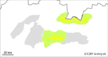
Snowpack
dp.6: cold, loose snow and wind
dp.7: snow-poor zones in snow-rich surrounding
Snowfall is expected to arrive in the morning, when up to 15 cm of new snow could be added. The flow this time will come from the south to south-west and should not be accompanied by strong winds. This means that the snow will remain dry and loose thanks to the freezing temperatures. Locally, however, there will be wind-blown snow slabs and pillows on some slopes, which have their typical features.
Tendency
During the whole day due to snowfall and reduced visibility, it is FREEZING.
Compiled by: Martin Bešinský