Avalances.sk

Tuesday 28.03.2023

Published 27 03 2023, 17:00


Danger level


Avalanche Problem
New snow
Wind slab
1600m


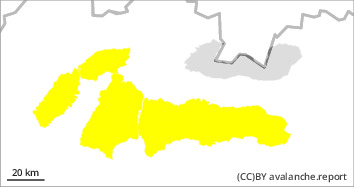
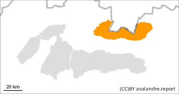
Due to strong wind and snowfall, there is an INCREASED avalanche danger in the High and Western Tatras at altitudes above 1700 m (3rd degree from the 5-part international scale). In other altitudes there is a MODERATE avalanche danger (2nd degree). The main avalanche problems are new snow and wind-blown snow (in the S, SE and E orientations). The new snow has fallen on the hard frozen firn base layer, which is not sufficiently bonded to it. On the leeward sides of ridges, in narrow steep couloirs and terrain depressions, the wind has created wind-blown pillows and slabs, the stability of which is low. Avalanches can be released in such places with only a small additional load. Due to the expected additional precipitation and windy weather, the avalanche danger tendency persists.

Snowpack

A wavy cold front brought snow showers during Monday afternoon, especially in the eastern parts of the mountain ranges. Further snowfall and strong northwest to north winds are expected during Tuesday, averaging up to 20 m/s (72 km/h) at the highest altitudes. For the last period of snowfall (Monday afternoon + overnight into Tuesday), we expect an accumulation of up to 25cm of new dry snow, which will be transported by winds to leeward S and SE exposures. The snowpack surface is variable, with hard, frozen snow on the windward sides of ridges and peaks. On the leeward sides the wind has created pillows and slabs of varying thickness and hardness .

Tendency

with snow and precipitation persisting

Danger level


Avalanche Problem
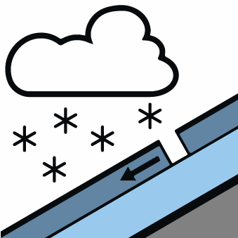
New snow
Wind slab
1600m


Due to strong wind and snowfall, there is an INCREASED avalanche danger in the High and Western Tatras at altitudes above 1700 m (3rd degree from the 5-part international scale). In other altitudes there is a MODERATE avalanche danger (2nd degree). The main avalanche problems are new snow and wind-blown snow (in the S, SE and E orientations). The new snow has fallen on the hard frozen firn base layer, which is not sufficiently bonded to it. On the leeward sides of ridges, in narrow steep couloirs and terrain depressions, the wind has created wind-blown pillows and slabs, the stability of which is low. Avalanches can be released in such places with only a small additional load. Due to the expected additional precipitation and windy weather, the avalanche danger tendency persists.

Snowpack

A wavy cold front brought snow showers during Monday afternoon, especially in the eastern parts of the mountain ranges. Further snowfall and strong northwest to north winds are expected during Tuesday, averaging up to 20 m/s (72 km/h) at the highest altitudes. For the last period of snowfall (Monday afternoon + overnight into Tuesday), we expect an accumulation of up to 25cm of new dry snow, which will be transported by winds to leeward S and SE exposures. The snowpack surface is variable, with hard, frozen snow on the windward sides of ridges and peaks. On the leeward sides the wind has created pillows and slabs of varying thickness and hardness .

Tendency