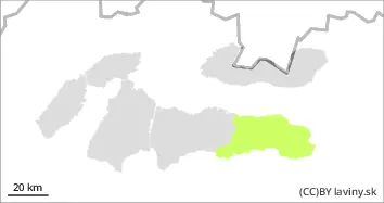
Avalances.sk

Monday 29.04.2024

Published 28 04 2024, 17:00


Danger level

1800m
Avalanche Problem
Wet snow
1800m


Watch out for wet avalanches when it warms up during the day!

Moderate avalanche danger (2nd degree) persists at altitudes above 1800 m a.s.l.. Due to strong warming, wet snow is becoming the main problem in all orientations. Avalanche release is possible especially with high additional loads, but spontaneous avalanches from wet snow are also expected on steep slopes.
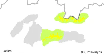
Snowpack

Due to the strong warming and south wind, the snow cover has been wet since the morning. At altitudes above 1500 m there is a layer of newer snow from the last snowfall on top of the older firn snow. The new snow has not yet gone through the firn formation process, it is very "sticky and cottony" The boundary of the continuous snow cover is rising day by day, it is currently about 1500 to 1600 m above sea level depending on the orientation.

Tendency

Rising during the day in sunny weather. FK


Danger level

1700m
Avalanche Problem
Wet snow
1700m


Smaller avalanches from wet snow may occur locally.

In the highest altitudes of the eastern part of the Low Tatras (above 1700 m asl) there is a SMALL avalanche danger, 1st degree. Smaller avalanches can occur only on very steep slopes. Firstly, with greater additional loads, or smaller spontaneous avalanches and slides, especially with warming temperatures and sunshine in the midday hours.

Snowpack

The snow cover is mostly made up of new snow. Only at the highest altitudes and in troughs is there old firn snow under the new snow. Due to the strong warming and south wind, the snow has been wet since the morning. The boundary of the continuous snow cover is rising day by day, currently from about 1600 - 1700 m above sea level depending on the orientation.

Tendency

Slightly rising as the day warms up. FK