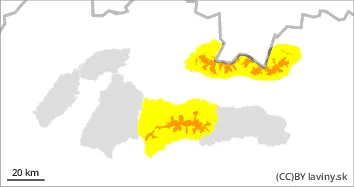
During Tuesday, the High, Western and Western part of the Low Tatras is in the morning for the highest altitudes (above 1600 m above sea level) an increased avalanche danger, i.e. 3 degree from the 5-part international scale. The weather of the last days (Sunday evening and Monday) - massive precipitation and strong winds, caused instability in many places. The main avalanche problems are new snow (on all exposures) and wind blown snow on E, S, SE, and SW orientations , even on smaller slopes. . Wet snow is the main avalanche problem in the middle and lower elevations. The weather pattern suggests that the wet snow problem will move to higher exposures. The aggravation due to warming, sunlight and possibly additional rainfall even at the highest altitudes will cause the snow profile to become soaked to such an extent that spontaneous avalanches and even spontaneous foundation avalanches are imminent. An increased avalanche danger is therefore also in force for the mid-altitudes in the afternoon.
Snowpack
At the highest altitudes, up to 40cm of new snow has fallen in the last period. Due to very strong winds, it was intensively moved to the leeward sides of the mountains or to places with a lower slope. In many places, the wind has created snow pillows and fragile slabs that lie on top of a hard layer of old snow. The large difference in hardness and the brittleness of the slabs of wind-beaten snow have thus caused a high degree of instability in many places.
Tendency
The avalanche hazard trend is persistent.
AM Danger level
Avalanche Problem
Wet snow
Wind slab
1400m
PM Danger level
Avalanche Problem
Wet snow
Wind slab
1400m
Watch out for waterlogged snow in major avalanche paths.
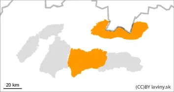
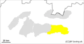
Since noon, the Fatra Mountains and the eastern part of the Low Tatras have been under an increased avalanche danger, i.e. the third level of the five-part international scale. An influx of warm sea air during Monday, combined with rainfall, caused a gradual heaviness and wetting of the snow cover. In some places (S,SE,E) of the highest altitudes (above 1400 m above sea level) it is possible to find smaller slabs and pillows of packed snow from the last snowfall period. However, the main avalanche problem is wet snow, which can be released in the form of spontaneous or spontaneous foundation avalanches. Thus, frequent avalanche paths, places with a high height of accumulated snow and a large collecting area are dangerous.
Snowpack
The old snow cover was gradually becoming soaked due to Monday's rainfall in the form of rain. Continued high temperatures during Tuesday and less cloud cover will cause further soaking of the snow cover, leading to instability.
Tendency
Danger level
Avalanche Problem
Wet snow
Watch out for waterlogged snow in major avalanche paths.
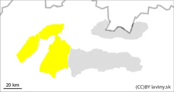
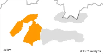
For the eastern part of the Low Tatras there is a moderate avalanche danger, i.e. the second degree of the five-part international scale. An influx of warm sea air during Monday, combined with rainfall, caused a gradual heaviness and wetting of the snow cover. The main avalanche problem is wet snow, which can release in the form of spontaneous avalanches. However, medium or larger avalanches are not expected due to this problem due to the lower snow depths in the region.
Snowpack
The old snow cover was gradually becoming soaked due to Monday's rainfall in the form of rain. Continued high temperatures during Tuesday and less cloud cover will cause further soaking of the snow cover, leading to instability.