Danger level
 |

Changing temperatures - favourable avalanche situation, icy terrain, risk of slipping.
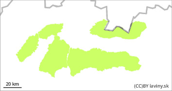
In all mountain ranges there is a low avalanche danger, i.e. level 1 of the 5-part international avalanche scale. During Wednesday, we experienced an influx of higher air pressure accompanied by strong winds and cooling. The daytime warming during Thursday and the subsequent overnight freezing had a positive effect on the stability of the snow cover, but at the same time, at high altitudes, a hard, in places icy layer formed on the surface of the snow cover in many places. Relatively warm weather is expected again during Friday, but this will be accompanied by strong winds, so no melting of the snow cover is expected. Avalanche release is only possible on local very steep shady and leeward slopes where there may be still unbound snow deposited in smaller slabs or pillows that can be released by large additional loads. The current avalanche danger is thus not being buried, but rather being swept by a small avalanche into very exposed terrain.
Snowpack
The alternation of plus daytime and negative night temperatures caused a gradual melting of the snow cover in all mountain ranges of Slovakia. A crust formed on the surface of the snow cover at lower altitudes and an ice layer at higher altitudes. Dry, untreated snow can be found only in local places, especially on shady slopes exposed to the north. Snow cover is not expected to melt during Friday due to strong winds.
Tendency
The tendency of the avalanche danger level development is persistent due to the alternation of daytime plus and nighttime negative temperatures.
Compiled by: Martin Buliak