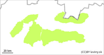
Danger level
 |

Stable situation
Avalanche danger level 1 (low danger) has been declared for all our mountain ranges The cooling during Wednesday has stabilized the softened and melted snow cover. Only in the high altitudes of the High Tatras, in shady, mainly east-facing exposures, there may still be pillows and slabs of wind-beaten snow, which could be released by a large additional load.
Snowpack
On Wednesday, a passing cold front brought a small amount of snow, only a dusting or 1-2 cm of new snow was recorded. So far the snow cover has been almost everywhere settled, load-bearing and softened during the warming period (Sunday to Tuesday). The subsequent cold snap is very stabilising, the snow layers are firmly bound together, the surface is frozen, even icy in places. Only in the high altitudes of the High Tatras, pillows and slabs of wind-blown snow from previous periods remain in the shady, mainly east-facing exposures.
Tendency
Snowfall with strong winds is forecasted for Thursday night into Friday.
Zostavil: Ivan Chlebovec