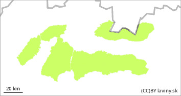
Danger level
 |

Relatively stable situation
Avalanche danger level 1 has been declared for all our mountain ranges. There will be a significant cooling during the day, which will stabilize the softened and melted snow cover well. Only in the high altitudes of the High Tatras, in shady, mainly east-facing exposures, there may still be pillows and slabs of wind-beaten snow that could loosen with a large additional load.
Snowpack
After the previous three days of very warm inversion weather, the cold front will cool down and the air temperature in the mountains will drop below 0°C again. The snow cover will thus become firmer and well stabilised. Snowfall is forecast for the afternoon.
Tendency
Slightly rising with snowfall.