Danger level
 |
|  |  |

![]()
Watch out for wet snow on sunny slopes on southern exposures.
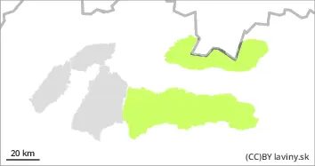
In the Tatras and Low Tatras there is only a SMALL avalanche danger = 1st degree. Snow cover is generally stable. The snow cover is firn-like and stable in most locations. Avalanche release is possible only sporadically on exposed southern slopes, especially with the arrival of midday and warming temperatures. Spontaneous avalanches are not expected.
Snowpack
The weather will be influenced by high pressure in the mountains of Slovakia, which will bring clear warm weather. Snow cover is generally stable, hard in the morning and gradually softening due to warming and sunshine. Depending on the orientation, the snow cover is between 1400 and 1700 m above sea level. Its height reaches 30 to 150 cm, with the most snow in the Low Tatras.
Tendency
Rising as midday and warming approaches, falling towards evening.