Danger level
 |
|  |  |

![]()
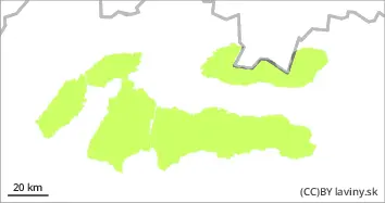
Watch out for wet snow on S orientations, locally smaller snow pillows of new snow can be found on the S sector.
In all mountains of Slovakia there is a low avalanche danger (1st degree). The snow will harden at night and will melt during the day due to the influx of warm air and sunlight, especially in the middle altitudes on the southern exposures. Strong southerly winds carried the new snow from Thursday afternoon to the S side of the mountains, where new snow can be found in the highest localities, deposited in smaller pillows and slabs. The current situation is well discernible on the ground, watch for more thickness of waterlogged snow, on the other hand, watch for isolated pillows of blown snow on the S exposures of the highest elevations.
Snowpack
The weather during Sunday will continue to be influenced by the edge of the high pressure. It will continue to be very warm, with temperatures reaching positive figures at altitudes below 2000 m a.s.l. Snow will harden overnight and then soften again during the day, especially in the mid-altitudes. The surface is very hard and firn-like in the morning, gradually softening in the south during the day. The snow cover is well below average, especially at altitudes up to 1500 m above sea level.
Tendency
With the expected development of the weather decreasing.
BL