Watch for snow pillows on the leeward (E) sides of the mountains and snow accumulation during the day on the S sides.
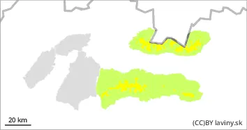
In the High , Western and Low Tatras it is valid at the highest altitudes - from 1700 m above sea level. MODERATE avalanche danger (i.e. 2nd degree of the 5-part scale). Significant snowfalls from the last snowfall period were often blown by strong winds up to the forest zone. However, on the leeward sides of the mountains (especially NE,E and SE), snow pillows and slabs are locally formed by the wind at the highest elevations and stability may be low, especially on steep to very steep slopes. Avalanches can be triggered locally, especially by large additional loads. At mid-altitudes the snow has settled and stabilised due to the temperature change. During the day, on the south-facing slopes, it will gradually become heavier, which will reduce its stability. During the day, small spontaneous avalanches may occur sporadically here (S exposures), mostly from wet snow.
Snowpack
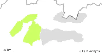
The weather during Sunday will be influenced by a pressure high, during the day we expect bright sunny weather and gradual cooling. Snow from the last snowfall period has been blown by strong winds into the valleys, windward sides are often blown to the base, but locally it may also be deposited on the NE, E and SE exposures of the mountains in the form of smaller pillows and slabs. At the highest elevations of the predominantly N exposures it retains a dusty character, while in the steepest elevations a crust or layer of firn is formed on the surface. During the day, the snow will become wetter and packed on the S slopes due to warming. The total snow cover is still below average. In the morning, the surface of the snow cover will be hard, especially in the mid-elevations.
Tendency
With alternating temperatures decreasing.
Danger level
Avalanche Problem
Wet snow
Watch out for snow accumulation during the day on the sun-exposed sides of the J.
In the Fatra Mountains there is a SMALL avalanche danger (i.e. 1st degree of the 5-part scale). New snow from the last snowfall period here was often blown by strong winds up to the forest zone, locally smaller slabs or pillows of wind deposited snow can be found on the E oriented slopes. Generally, however, the snow cover has settled and stabilized with the warming of the last days and the subsequent nightly freezing. The main avalanche problem is wet snow, which will cause solar radiation during the day, especially on S sun-exposed slopes. Spontaneous avalanches of wet snow may occur during the day.
Snowpack
The weather during Sunday will be influenced by a strong pressure high, during the day we expect bright sunny weather. The 0°C isotherm will gradually reach the mid-latitudes. Snow is unevenly distributed in the terrain. The strong winds of the last few days have blown it to the SE and E sides of the mountains, while the windward sides of the mountains are blown onto the hard underlying firn layer or up to the soil surface. Due to the change in temperature, the snow cover has settled and stabilised, with a crust or layer of firn forming on its surface. The conditions in the mountains will naturally change during the day - the surface of the snow cover will be very hard in the morning, while during the day the snow on the southern slopes will become wet due to sunlight. The overall snow cover is still below average.