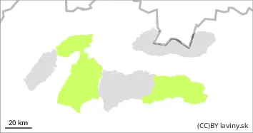
Danger level
 | treeline |
|  |
|  |

![]()
Beware of wind-drifted snow above the tree-line!
Moderate avalanche danger in the high altitudes of the High, Western and Low Tatras, 2nd degree. After a significant cooling associated with snowfall and very strong winds, 5 to 15 cm of new snow fell (Monday) over the tree-line. The snow is being blown by the wind onto the leeward slopes, especially in the E, SE and S orientations, where it can reach a thickness of more than 30 cm. On steep slopes, in troughs, under saddles and under rock walls, there are therefore snow slabs and pillows that are not sufficiently bonded with the former surface. Avalanche release in these areas is possible, especially with high additional loads.
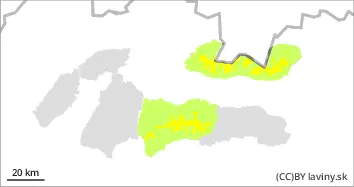
Snowpack
The surface of the snow cover consists of new, wind-blown dry snow 5 to 15 cm thick at higher altitudes. Underneath, at altitudes above 1600 m above sea level, there is a frozen layer of newer snow from the previous snowfall (Friday-Saturday), when 10 to 30 cm of new snow fell. It fell during the warm SW flow until it got significantly colder on Sunday evening. On Tuesday we expect sunny weather with only light winds, sunlit slopes will quickly stabilise. Shaded slopes a little slower.
Tendency
persistent